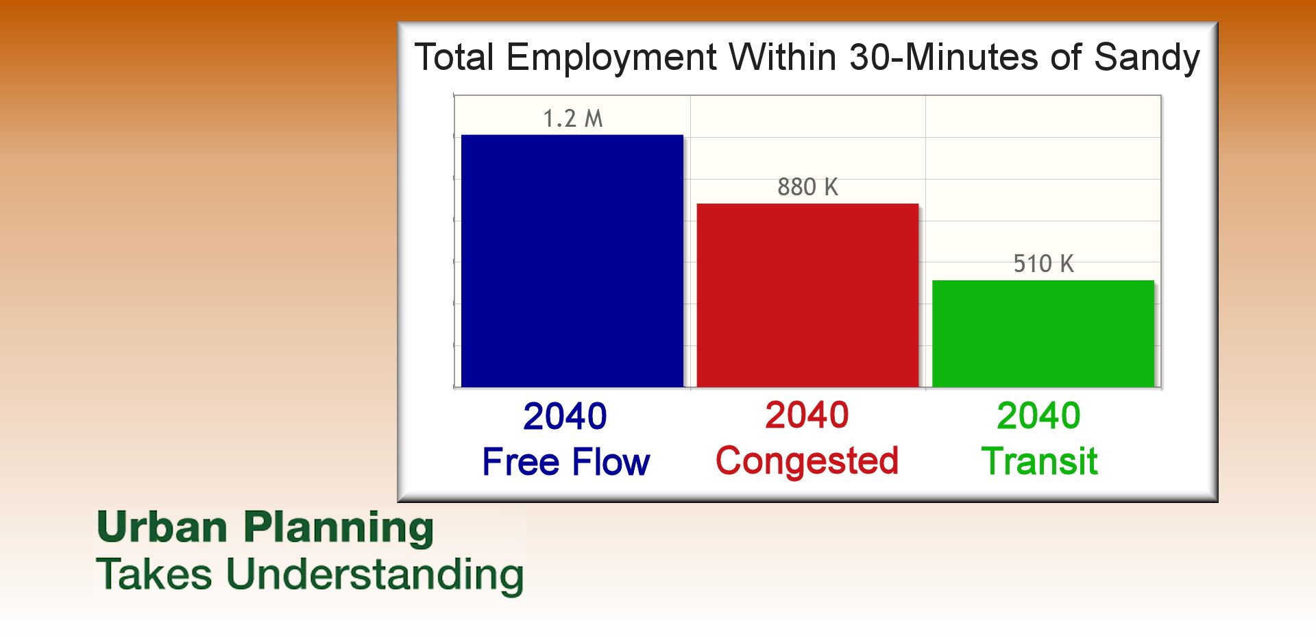
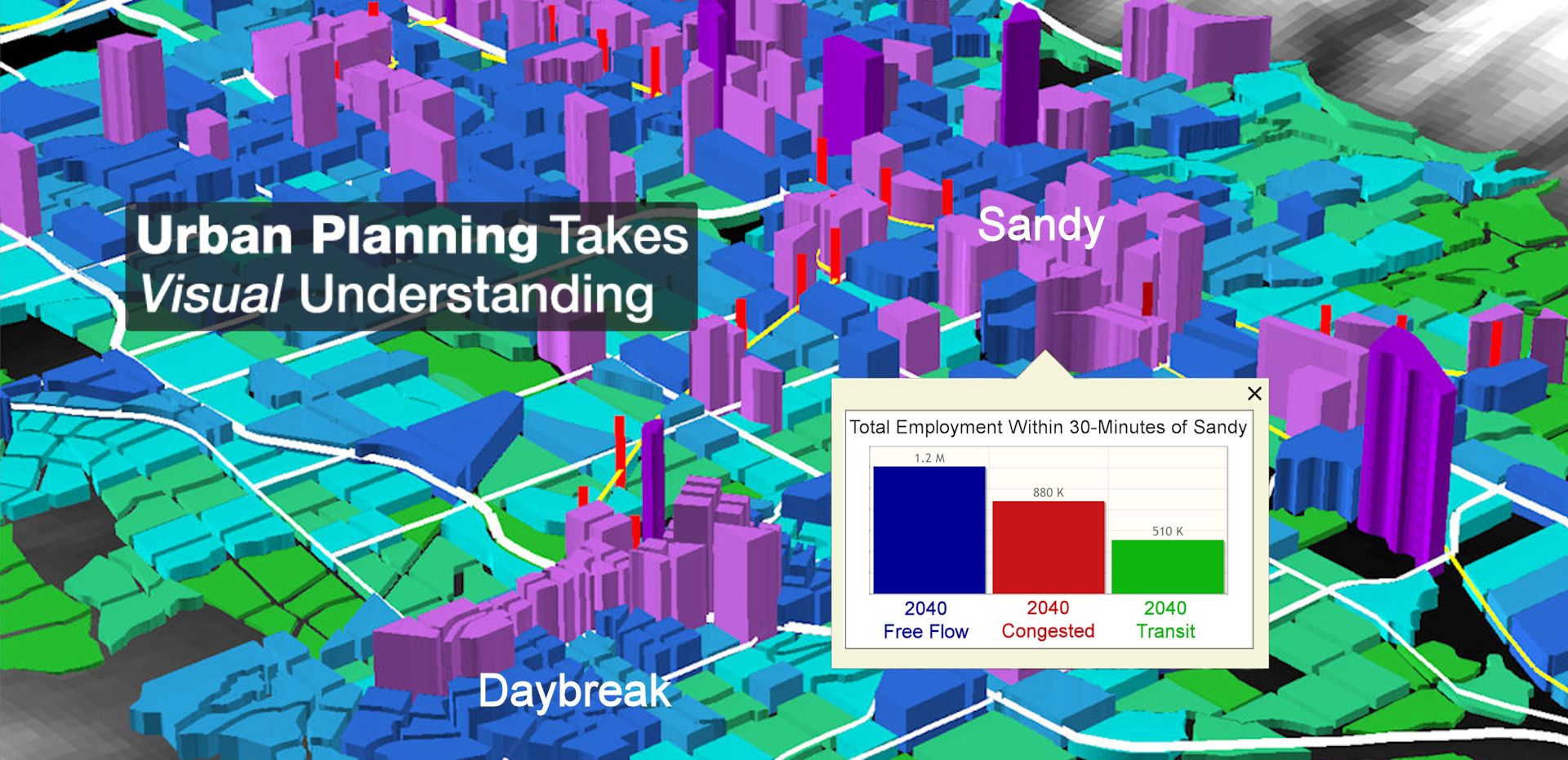

What can you reach in 30 minutes?

Is your travel model seeing your land use plan correctly?

Can you see your results with 3D tours on the web?

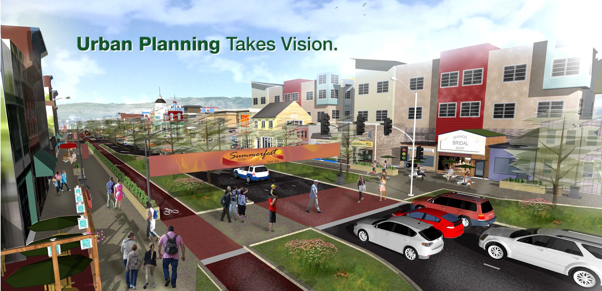
Do you want to reduce congestion AND have great places

Want to reduce pavement, AND also reduce congestion?

Do you have a through street at least every half-mile?

Is your project good for pedestrians?